
Agua Fria Wildlife Preserve
by Bob Terry

View of the Agua Fria River valley looking toward Indian Mesa (upper left), April 1998. Lake Pleasant was full after the heavy winter rains, and extended to the sandbar in the middle left of the photo. (©1998 Cliff Drowley)
The Agua Fria River valley above Lake Pleasant, extending from Black Canyon City to the northeast corner of the lake, is a place of promise. The southern end of this valley was originally Boulder Creek Ranch and generally off limits to outsiders. To accommodate the New Waddell Dam's higher water levels, the Bureau of Reclamation bought the ranch. The Bureau turned over the ranch and the rest of the land surrounding Lake Pleasant to the Maricopa County Parks Department to create Lake Pleasant Regional Park.
There is only one road into the valley, Table Mesa Road (Exit 236 off I-17). This road leaves the valley to the west on its way to the Humbug/Columbia mines area. It is possible to enter the valley from the west, but it is not recommended without a four-wheel drive vehicle.
The valley itself is a striking place. Mesas to the east rise steeply with 2000 foot cliffs. The cliffs provide secure nesting areas for raptors and other birds.
A pair of Bald Eagles have nested in the area for a number of years, fledging at least eight young. To the west, Indian Mesa rises 1000 feet above the valley floor with vertical limestone cliffs all the way around, and an ancient Amerindian village on the top. Unfortunately, there has been no access control, and artifacts have been removed from the site.
Human activity has impacted the valley in a number of ways. The rise and fall of Lake Pleasant (a 100-foot-plus elevation differential) creates a seasonal lake in the widest part of the valley. Several mesquite bosques have been totally or partially killed off by the flooding. One large cottonwood died due to the periodic inundation, and now provides a rookery for Double-crested Cormorants, and possibly Great Blue Herons, both of which are fairly common in the valley.
There is little that can be done about the periodic flooding, although building low dams to create standing water year around would mitigate the seasonal flooding impact.
Other human activities in the valley have been less benign. Anglers fishing the lake at high water have left trash and monofilament (fishing line) tangles which are a danger to all wildlife. ATV enthusiasts have raced their noisy vehicles on the dried lake bed, and created new trails through the surrounding desert. Visitors evidently like canned beer and the empty cans litter the landscape. Some of the cans wind up as targets for plinkers, although it is against the law to possess a loaded weapon in any Federal, State, County or City park. The valley abounds with targets like Coopers' Hawks, wild burros, beer cans, even saguaro.
The preceding is the downside, of course. The upside is that the Agua Fria River valley is about to become a wildlife preserve, thanks to the Maricopa County Parks Department. Fencing has been installed to eliminate open-range cattle grazing from upstream allotments, and the Parks Department plans to restrict vehicular access and to station rangers in the area. Trash cleanups are planned in the near future to remove the accumulated debris from the last several years.
Even with the human impact noted above, the valley is truly striking. Galleries of cottonwood and willows line the banks of the year-round flow of water. A wash coming down from the saddle between Doe Mesa and Wild Burro Mesa is filled with low vegetation and birds. Tracks of desert mammals can be seen on the stream banks. In the past year, incidentally, a not-too-diligent bird survey has turned up more than 110 species.
Once the Parks Department completes their plan to relieve the valley of the stress of wheeled vehicles, and to enforce existing park codes, the Agua Fria once again will be one of the most beautiful places to visit in Arizona.
Getting There
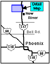
The Agua Fria valley is reached from Phoenix via I-17 North. The road to the park is just north of New River (see locator map). Take the Table Mesa Road exit (exit 236) and turn left to cross the freeway to the west. Turn right (north) on a frontage road just after crossing the freeway. The road becomes a dirt road, and parallels the freeway for about a mile, gradually diverging to the west. There are several side roads. The first major fork has a sign for New River Sand & Gravel; bear left (in general, the main road bears left at forks).
After approximately 4 miles, a wooden gateway with a sign for "Boulder Creek Ranch" appears; this is the park boundary. There's a flat area to the left a few hundred feet beyond the gate that is suitable for parking; a dirt road (noted as "Hillside Trail" in the detail map) starts at one end of the flat, and winds along the hills above the river as it goes downstream. A ranger station is planned for the right-hand flate area. The river bottom can be reached just downhill from the parking area, and can be forded at low water (exercise caution in fording, particularly if the river is running, which can happen at any time of year).
Detail map showing the Agua Fria valley and access road

Detail map showing the Agua Fria valley and access road
Birding suggestions
Birding the Agua Fria generally requires some hiking, either along old roads or the river bottom. Be certain to take plenty of water, sunscreen, and something to eat. Summer temperatures are typical for the Phoenix area, and best birding is in the early morning.
There are several possibilities for birding the area. The river bottom itself can be followed downstream for quite a distance during low water. Good cottonwood/willow galleries are located about 1/2 mile downstream from the ford, and provide habitat for warblers and orioles. Yellow-billed Cuckoo has been found. Herons and egrets may be seen along the river, and the sky should be periodically scanned for raptors, swifts, and swallows.
The Hillside Trail (actually a fairly rough dirt road) can be followed along the hills; this provides several good views of the river valley, and has good habitat for desert upland birds such as Ladder-backed Woodpecker, Gila Woodpecker, Black-tailed Gnatcatcher, Verdin, Black-throated Sparrow, and Cactus Wren. Spring brings migrants, including Black-chinned Sparrow. The trail passes through a gate, and eventually descends to a wash originating between Wild Burro Mesa and Doe Mesa. This wash can be followed down to the river, reaching the cottonwood/willow gallery mentioned above. One can return up the river or by going back to the trail.